CartoNuit, geolocation of fire fronts
The origins of the CartoNuit project
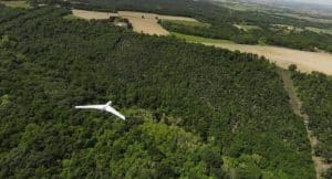
In summer, very hot temperatures make forest areas vulnerable to fire. Fire-fighting is particularly difficult at night, when darkness makes maneuvers and the use of standard aerial equipment impossible. The CartoNuit project, led by the Boreal consortium and Magellium Artal Group, and co-financed by the Occitanie region, aims to offer a drone solution for night-time forest fire surveillance. More specifically, the CartoNuit project aims to propose a solution for night-time drone monitoring of fire fronts and residual hot spots.
Magellium Artal Group collaboration
Magellium Artal Group's work on improving aerial image georeferencing and creating ortho-mosaics began in 2016. This work has led to the development of several software solutions, which have since been proven and made reliable as part of various projects supported by the French Ministry of the Armed Forces, including Aquila, LittleFox and Caméléon.
Our expertise in Artificial Vision led to the development of the CartoNuit solution. The solution consists of adapting the mosaic algorithm, data produced by the Boreal drone, continuous operation and data acquired at night.
How does the system work?
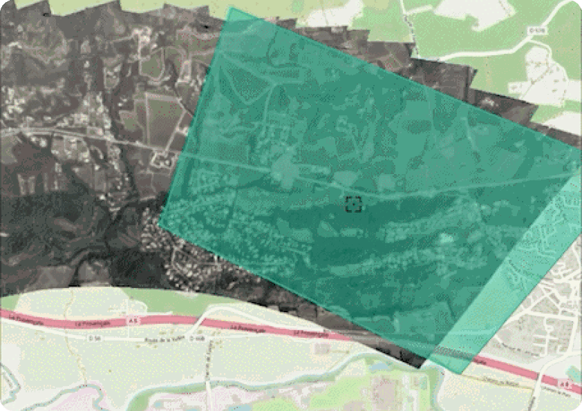
The proposed solution is as follows: a drone films the fire front according to a defined flight plan. On the ground, the video stream is retrieved and processed by a dedicated station, which provides ortho-images and vector data to visualise the advance of the fire front. These data can be viewed via a dedicated interface, and can also be exported to geographic information systems. It works in a similar way for locating hot spots.
What are the technical features of the CartoNuit project?
On board the Boreal drone, the TEMIS XL16 Merio turret produces and broadcasts a video stream in NATO STANAG 4609 format. This standard format guarantees that the video stream contains all the metadata required for geo-referencing: position of the carrier, attitudes, fields of view, etc.
On the ground, a dedicated ground station receives and processes the video stream, providing the operator with a control interface and the data produced. The components deployed here are as follows:
- the Aquila processing software solution, which decodes the flow, continuously produces ortho-mosaics and detects fire fronts and hot spots on these mosaics;
- a Geoserver server, receiving and hosting the ortho-images and detections produced by Aquila. These data are made available via WMS and WFS streams, making them accessible to any external geographic information system;
- the Littlefox Geofire graphical interface, which displays the data produced on a map, visualises the video stream, and provides rapid access to Hellion, the Aquila application control panel. The latter, accessible from any browser with access to the ground station network, lets you view the status of available components, as well as start and stop various processes.
Find out more about CartoNuit on the Constellations website 🔗