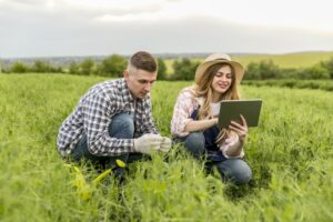
This project, a pioneer and leader in remote sensing management technologies, analyses crop needs. Farmstar provides tailor-made agronomic advice to optimise yields, harvest quality and respect for the environment.

From optical satellite imagery to more sustainable agriculture
Farmstar is a unique service worldwide. Operated by Airbus Defence & Space Geo Intelligence, it is designed to provide precise agronomic advice to agricultural cooperatives. The project aims to improve crop management through agronomic advice based on the analysis of optical satellite images and the provision of a nitrogen management service for farmers.
Farmstar has been working for over 20 years to support farming practices towards more sustainable agriculture. This service is recognized for its reliability and continuous innovation, and is the result of nearly 20 years of partnership between France's leading agricultural technical institutes(Arvalis - Institut du Végétal, Terres Inovia) and Airbus.
Magellium Artal Group's role in Farmstar
Since 2013, Magellium Artal Group has taken over the project and played a role in industrialising Farmstar, improving technical processes and integrating new technological solutions.
Thanks to our expertise in software and systems engineering, Farmstar underwent a significant transformation, aimed at stabilising and optimising the performance of the existing system. This evolution has enabled Farmstar to better meet business requirements and the specific needs of farmers.
Magellium Artal Group's tasks in industrialising the Farmstar system are manifold:
- Performance optimisation
- Improved storage management (files, databases, etc.)
- Parallelisation of processing
- Recoding agronomic algorithms
- Improving the software strain
- Revamped error handling mechanism
- Setting up logging mechanisms to monitor production
- Code slicing for better decoupling
- Improving the software factory
- Standardised construction tools / Continuous integration
- Test strategy definition
- Structuring / Improving the document base
These advances enable Farmstar to adapt to the specific conditions of each plot, maximising the effectiveness of agronomic interventions.
Farmstar technical specifications

Farmstar generates advice using Earth observation remote sensing satellites. Their orbit, at an altitude of 800 kilometers, passes regularly over the fields to track their evolution over time. Vegetation reflects sunlight in different ways as it develops. This signal is picked up by the satellite, processed and converted into measurements of the state of the vegetation (biomass, chlorophyll).
The institutes deduce all Farmstar advice, which regularly and continuously analyses crop phenological cycles . This analysis, correlated with technical information on the farmer's practices, as well as with agronomic information on the plot and the yield targets set, enables us to deduce the amount of nitrogen the plant really needs. This is what we call modulation technology. In this way, Farmstar helps to determine the precise dose of nitrogen to be applied to each area of the field, in a heterogeneous and optimised way, while adapting to the local particularities of the plot.
Farmstar ensures these precise, personalised agronomic recommendations by processing and analysing satellite data. The Farmstar system uses technologies such as Java, Python, GDAL, IDL and Overland for data processing, while Angular is used to develop intuitive user interfaces. Data management is carried out via PostgreSQL with PostGIS, facilitating efficient management of geospatial information. Reports are generated using JasperReports, and continuous integration is managed using GitLab.